

The feud began in the hills along the Tug Fork, but much of it was settled in Pikeville. This is where McCoy partisans pressed for arrests, where Hatfield men were brought to stand trial, and where the only legal execution of the feud took place. The town sits about thirty miles west of the Tug, on the Levisa Fork of the Big Sandy, and it has changed more than almost any town in the region. You can still read the feud years in its streets if you know where to look.
A town in a river bend
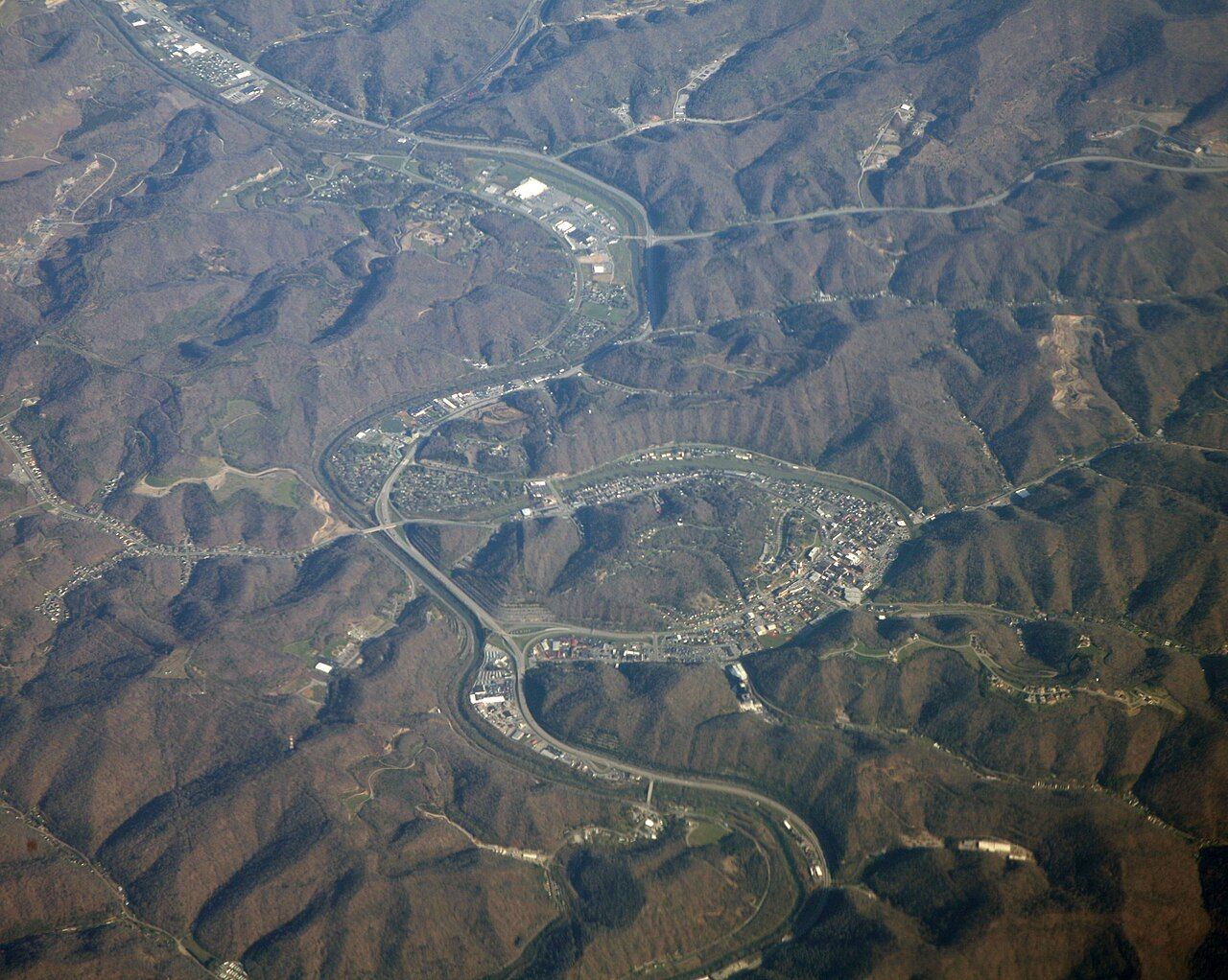
Pikeville was laid out in the 1820s as the seat of the new Pike County. The Levisa Fork made a tight loop here, and the town filled the flat ground inside it: a courthouse square, a main street parallel to the river, and houses climbing the slopes. For most of the nineteenth century, getting here meant river travel, horseback or rough wagon roads over the ridges. The railroad did not arrive until the early twentieth century.
When Randolph McCoy's family fled their burned cabin on Blackberry Creek in January 1888, they came here. Town meant a jail, a courthouse and lawyers, and it meant neighbors who could not easily be surprised at night. Randolph and Sarah lived out their lives in Pikeville. They are buried on the hill at Dils Cemetery, which overlooks the downtown.

The courthouse square and the trials
The Pike County Courthouse anchors Main Street. In the late 1880s, after Frank Phillips's raids into West Virginia and the fight at Grapevine Creek, a group of Hatfield supporters was brought here in custody. The governors of Kentucky and West Virginia quarreled over whether those arrests were lawful, and the dispute went all the way to the United States Supreme Court, which in 1888 allowed Kentucky to keep and try the prisoners. That legal fight is covered in detail in our account of Grapevine Creek and the courts.
The trials ran through 1889. Several defendants received life sentences. One, Ellison Mounts, was sentenced to death for his part in the New Year's raid in which Alifair McCoy was killed. He was hanged in Pikeville in February 1890, before a large crowd, the only person executed by law for the feud. Accounts of the day differ on his last words and on how far he was a leader rather than a follower; the record is clear on the sentence and the date.
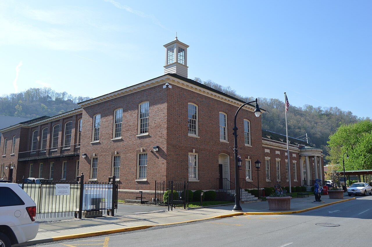
Walk the square slowly. The courthouse building, the brick streetscape and the federal building nearby date mostly from the decades after the feud, but the street plan is old, and the distances are the same ones that lawyers, witnesses and onlookers walked during the trials.

The Cut-Through
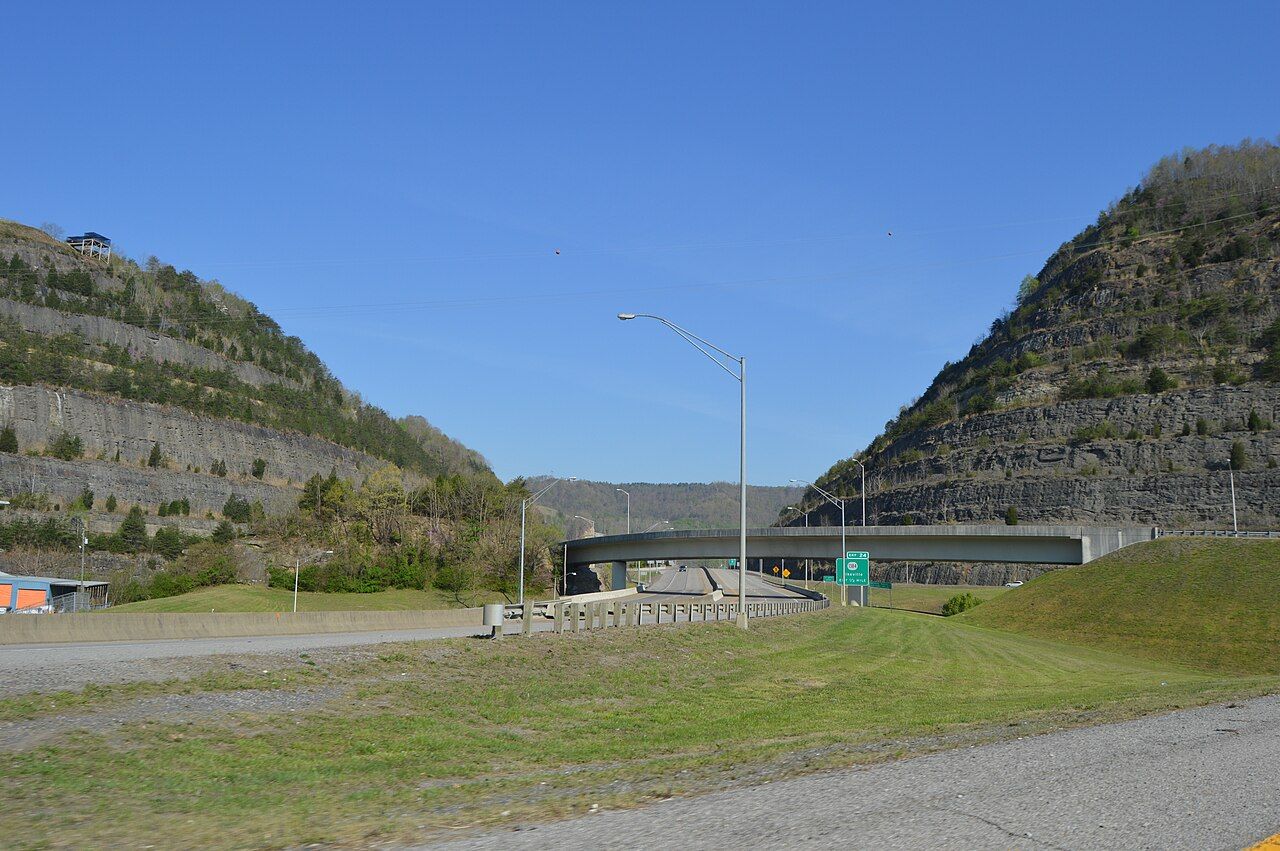
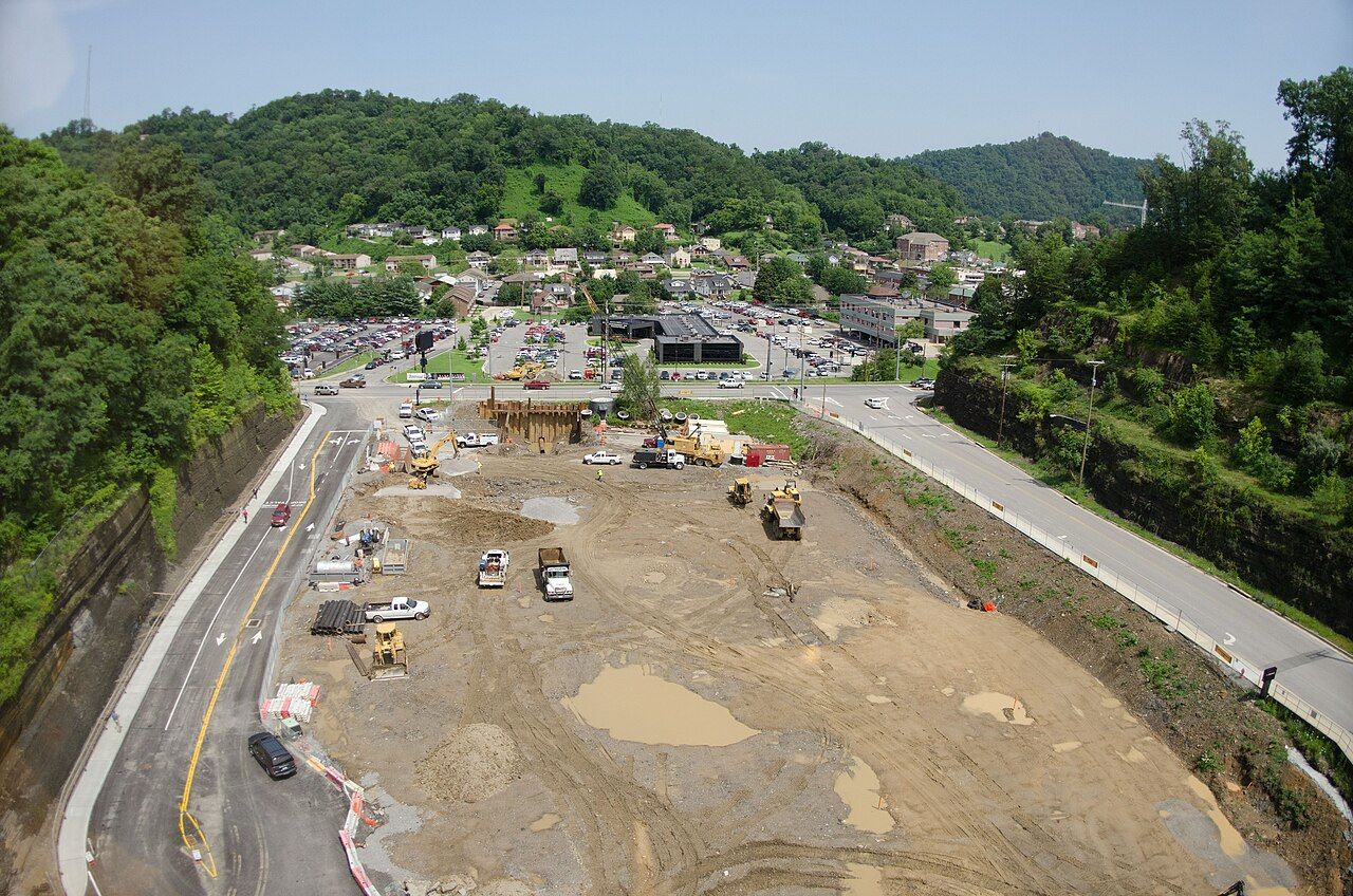
The biggest thing in Pikeville is not a building. It is the gap in the ridge west of town. For years Pikeville flooded when the Levisa Fork rose, and the river loop, the railroad and the highway all crowded the same narrow ground. Starting in the 1970s, engineers cut straight through the mountain beside the town, then moved the river, the railroad and US 23 into the new channel. Work ran for roughly fourteen years and was finished in 1987.
The project is often counted among the largest earth-moving jobs in the Western Hemisphere; the figure usually given is around eighteen million cubic yards of rock and soil. The old riverbed inside the loop was filled and is now level ground in the middle of town. You see the result best from the highway, where rock walls rise on both sides, and from the hills, where the shape of the old loop is still plain.
You can still read the feud years in its streets if you know where to look.
Roads climbing the hills around town give views down into the cut and across the filled loop.
Another stop · MatewanMatewan: one small town, two hard historiesA walking order for the feud sites
Downtown is compact, but the hills are steep. This order keeps the climbing to the end:
- Start at the courthouse square. Find the state historical markers that tie the courthouse to the feud trials, and give yourself a few minutes on the square to picture the crowds of 1889.
- Walk Main Street. Several blocks of early twentieth-century brick commercial buildings form a historic district. Look up at the cornices; the ground floors have changed many times, the upper stories rarely.
- Visit the local museum. A heritage museum downtown holds material on the Big Sandy valley, including the feud years.
- Drive up to Dils Cemetery. The lane is too steep and narrow for a pleasant walk with traffic. Park carefully, find the McCoy graves and look back down over town.
- End on high ground above the Cut-Through. A view from the hills puts the whole town in context: the old loop, the new channel and the ridges that kept Pikeville isolated through the feud years.

Pikeville today and how to plan
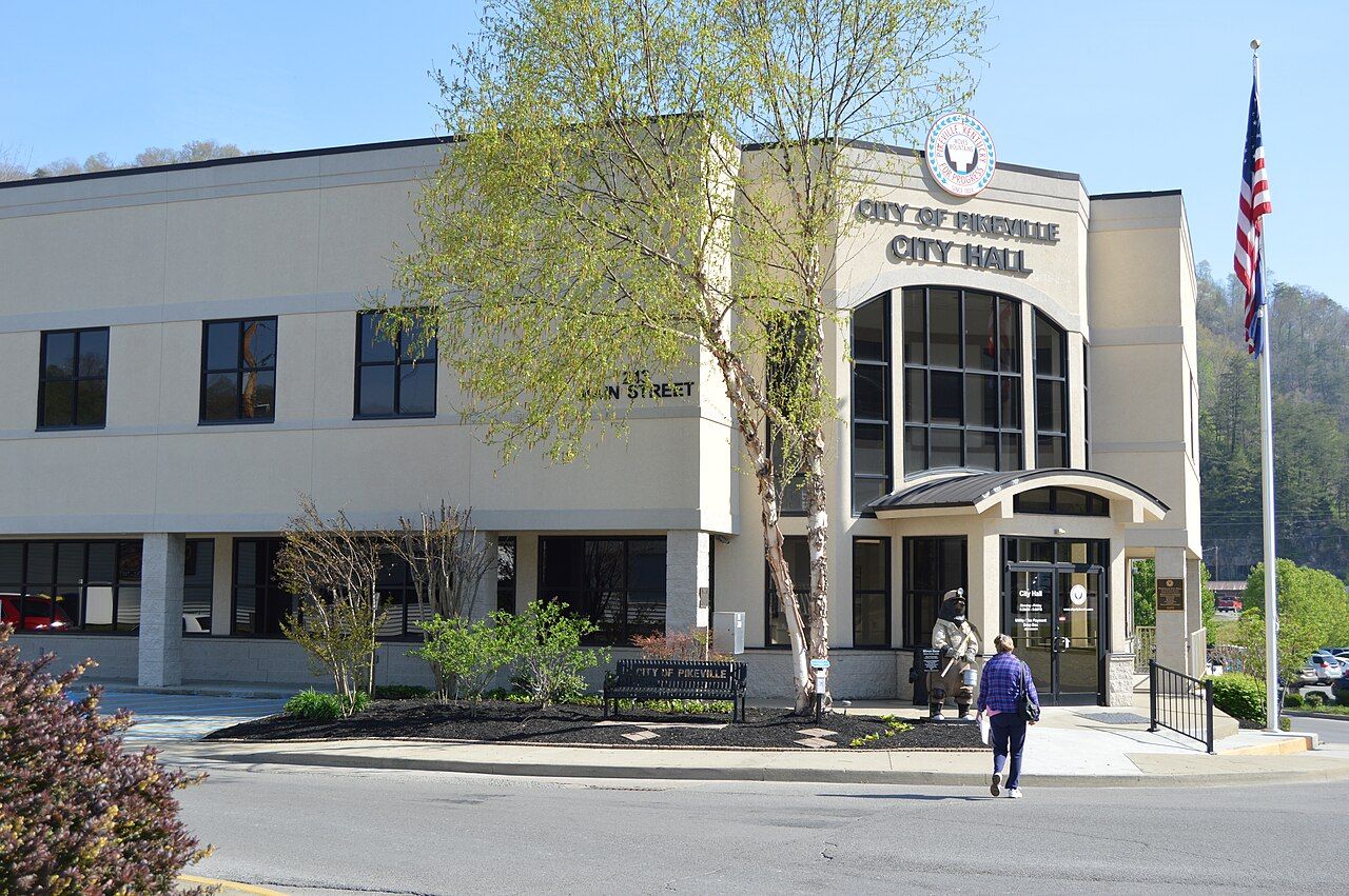
Pikeville is the largest town on the Kentucky side of feud country and the easiest base for its western half. It has a university, a large regional hospital and a busy downtown. The medical center expansion seen from the hill shows how the town has kept growing into every flat corner the valley allows. Expect traffic at shift changes and on weekdays when the courts and offices are busy.

From here, US 119 and the state roads that branch from it lead toward the McCoy country along Blackberry Creek, and the same highway heads northeast to Williamson and the Tug. The drive to the river takes under an hour in good conditions, but the back roads are narrow and slow, and phone signal fades in the hollows. A good plan is a full day in Pikeville and the McCoy sites, then a second day across the river on the Hatfield side; our two-day route sets out the order.
April, May, September and October are the kindest months for these roads. In April and May, the hills turn green from the bottom up and redbud and dogwood show on every slope. October brings color and cooler walking weather. Summer is hot and humid in the valley, and winter can close the back roads after snow.
Pikeville takes the feud seriously without making a theme park of it. Markers tell the record plainly, the graves are quiet, and the courthouse is still a working courthouse. That restraint suits the place.