
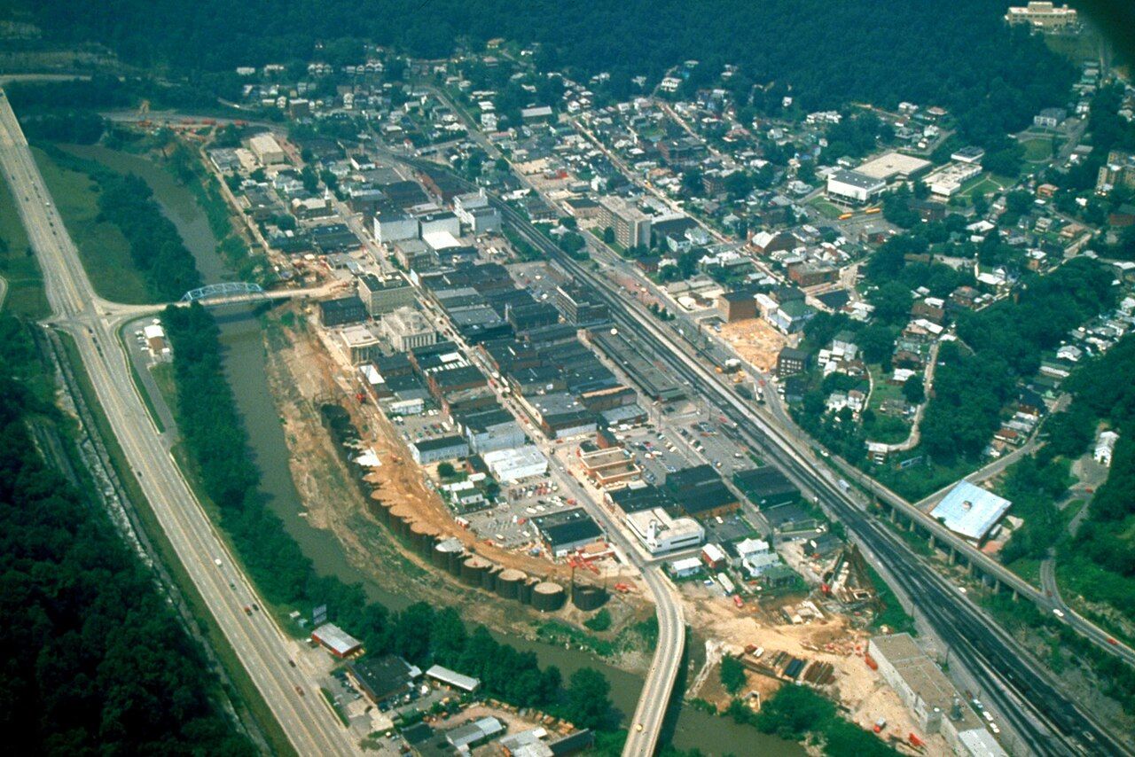

Williamson is the town the railroad made. Before the Norfolk and Western laid track along the Tug Fork in the early 1890s, this stretch of bottomland held farms and a few scattered houses. Within a generation it was the seat of a new county, a rail division point and one of the busiest coal shipping towns in the region. It still looks the part: a grid of brick buildings squeezed between the river, the tracks and the hill.
A county seat on the Tug
Mingo County was carved out of Logan County in 1895, and Williamson became its seat. The name Mingo recalls the Mingo people, Iroquoian speakers who lived in the upper Ohio valley in the eighteenth century. The courthouse, the county offices and the old commercial blocks stand within a few streets of one another, and a bridge crosses the Tug to South Williamson on the Kentucky side.
The town's position on the border shaped daily life. People worked, shopped and married across the river, and through the feud years and after, the Tug was less a wall than a street running between two states. For more on how the river worked as a boundary, see our guide to the Tug Fork.
The Coal House
The building everyone comes to see is small. The Coal House, finished in 1933, was built with walls of cut bituminous coal from a nearby mine; the usual figure is about sixty-five tons. The blocks were sealed with a varnish to protect them from weather, and the building has come through more than one flood. It has long served as a chamber of commerce office and visitor stop.
Close up, the walls have a dull black sheen and a texture more like stone than you might expect. The building was meant as an advertisement for the coalfield, a way of saying what the valley made and shipped. It works as a symbol now for a different reason: it shows how completely coal shaped the town's idea of itself.
The floodwall and its murals
The Tug Fork has flooded Williamson many times. The flood of April 1977 was the worst in living memory, putting water deep into downtown and devastating communities up and down the valley. In the years that followed, the US Army Corps of Engineers built a floodwall around the town, with gates that close across streets and rail lines when the river rises.
Concrete walls are not usually a reason to stop, but this one carries murals. Painted panels show scenes from local history: coal miners, the railroad, the river, and figures from the region's past, including the feud years. Walk along it slowly; the panels reward attention, and they give a quick, visual history of the valley. Murals are repainted and updated from time to time, so what you see may differ from older photographs.
Another stop · Tug ValleyCoal and the Norfolk and Western: how the rails remade the valleyThe rail yards
Williamson's yards were built to gather coal from the branch lines running up the side hollows and to send it east to the coast or west to the Ohio River. The Norfolk and Western's line along the Tug opened the whole Pocahontas coalfield to markets, and Williamson became one of the places where loaded cars were sorted into long trains. The line is part of Norfolk Southern today, and coal trains still pass through, though far fewer than at the peak.
You can watch trains from public streets and from the floodwall area. Stay off railroad property; the yards are private, active and dangerous, and trains move with little warning. The story of how the railroad remade the valley is told in our piece on coal and the Norfolk and Western.
Williamson and the feud
Williamson itself was barely a settlement during the feud's worst years, and none of the major feud events happened within today's town limits. It is, though, at the center of feud geography. The Hatfield homeplaces in what is now Mingo County, the site of the election-day fight on the Kentucky side and the stretch of the Tug where the three McCoy brothers were killed in 1882 all lie within a short drive. Matewan, a few miles upstream, is the closer town to those sites; see our Matewan guide.
Several Hatfield descendants later lived and worked in Williamson and the surrounding county, and the town plays host to events that remember the feud.
How to see it in half a day
- Park once downtown. The grid is small, and most of what you want to see is within a few blocks.
- Start at the Coal House. Walk around the outside before going in, if it is open.
- Walk the floodwall murals. Allow time to read the panels.
- Look at the courthouse and the old commercial blocks. The upper floors show the town's early twentieth-century prosperity.
- Watch the river. From the bridge to South Williamson you can see the Tug in its setting, with Kentucky on one bank and West Virginia on the other.
Spring and fall are the most comfortable seasons. Summer can be hot and humid in the narrow valley, and winter brings short days and occasional icy roads. Expect slow traffic behind coal trucks on the highways into town, and allow extra time.
Williamson is not a polished tourist town, and it does not pretend to be. Many storefronts are empty, and the population is well below its peak. That honesty is part of the visit. You see a coal town as it is now, with its history written on its walls.