
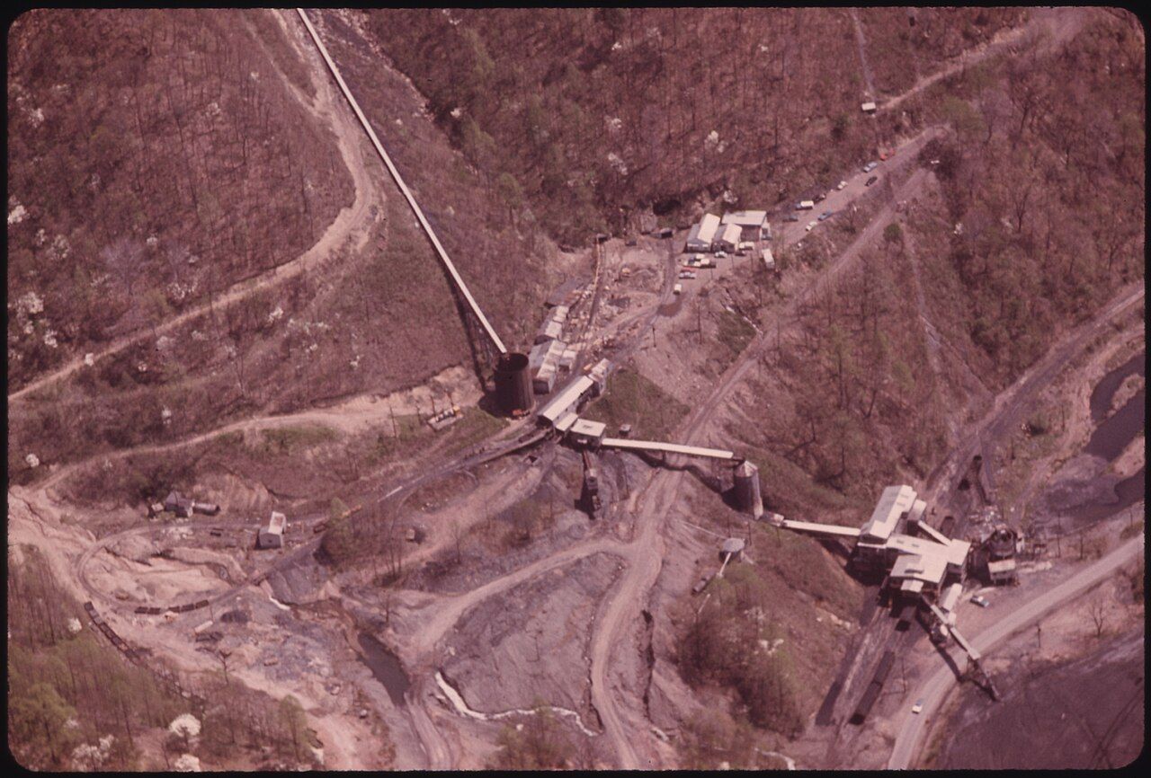

During the feud years, the Tug Valley was a place of small farms, timber cutting and long, slow travel. Getting a raft of logs downriver was the main link with the outside economy. In the space of a few years in the early 1890s, that changed completely. A railroad arrived, coal mines opened up the hollows, and towns grew where there had been fields. The coal and the railroad are the reason the region looks as it does today.
The coal under the ridges
The mountains of southern West Virginia and eastern Kentucky sit on some of the richest bituminous coal seams in the world. Geologists and surveyors knew of them before the Civil War, and farmers dug coal from outcrops for home use. What was missing was a way to move it. The rivers were too shallow and wild for large barges, and the roads were not built for heavy loads.
The Norfolk and Western Railway, based in Roanoke, Virginia, set out to solve that. In the early 1880s it reached the Pocahontas field near the Virginia-West Virginia line, and coal from there quickly gained a reputation for steaming quality. The next step was to push west to the Ohio River, opening new fields and new markets.
Down the Tug Fork
The route the N&W chose ran from the Pocahontas field down the Tug Fork valley to the Big Sandy and on to the Ohio near Kenova. Construction of this Ohio Extension began around 1890 and was completed in 1892, with tunnels, bridges and a line threading the river's tight curves. It ran mostly on the West Virginia bank, through the heart of the feud country.
The railroad arrived as the feud was ending. Some historians have argued that the pressure of land and timber deals tied to coming industry played a part in the later feud years. That argument is debated, but there is no question that the railroad brought outside capital, new law enforcement expectations and a flood of new workers into a valley that had been isolated for generations. For how that change touched the families, see our profile of Devil Anse Hatfield, who sold timber and land in those years.
Tipples, camps and company stores
Once the main line was in, branch lines ran up the side creeks to new mines. At each mine stood a tipple, a tall structure where coal from the mine was screened, sorted by size and dropped into railroad cars. Around many mines, companies built camps: rows of nearly identical houses, a company store, a church, a school and sometimes a doctor's office and a movie house.
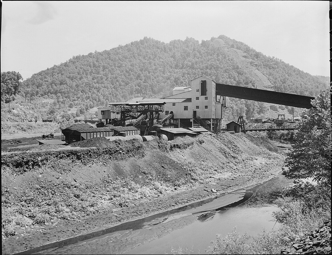

Life in those camps was tightly controlled. The company owned the houses and could evict at will. Wages were often paid partly in scrip, credit good mainly at the company store, where prices could be high. Miners came from the mountains, from Black communities in the South and from southern and eastern Europe, and the camps mixed languages, churches and food. Those conditions set the stage for the union struggles told in our account of the mine wars.
Another stop · WilliamsonWilliamson: a coal town built on the river's edgeWilliamson and the yards
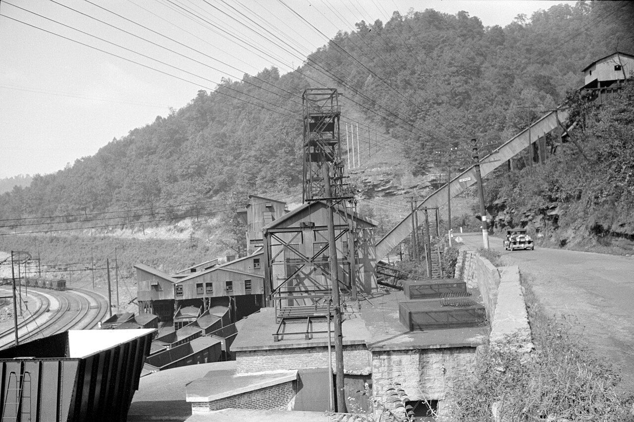
Williamson grew up as a key point on the line, with yards where cars from the branch lines were gathered into long trains. The N&W also built heavy-duty infrastructure across the coalfield: tunnels, bridges, and, on the steepest grades in McDowell County, electrified track from the 1910s, with overhead wires to help haul loaded trains over the mountains. Steam later gave way to diesel, and the electrification was removed in 1950.
The railroad merged into Norfolk Southern in 1982. Coal production in the region has fallen sharply from its mid-century peak, but trains still roll along the Tug. The town that grew around the yards is described in our Williamson guide.

What you can still see
- The main line. From US 52 and WV 49, you can often watch coal trains following the river. Stay on public roads and away from the tracks.
- Former coal camps. Look for rows of matching houses on the slopes of side hollows, sometimes with an old brick store or office building at the center.
- Tipples and load-outs. Some modern loading facilities are visible from the road. Older wooden tipples have mostly disappeared, though remains survive in places.
- Town buildings. Brick blocks in Williamson and Matewan were built during the boom years and show how much money once moved through the valley.
- The Coal House. In Williamson, a 1933 building made of coal blocks stands as a monument to the industry.
Mine sites, tipples and rail yards are private and often active. Do not walk onto them, and do not stop on narrow shoulders near haul roads, where large trucks may come around a curve with little warning.
Reading the valley as you drive
Once you know what to look for, the coal and railroad history is everywhere. A flat, unnaturally straight shelf on a hillside may be an old rail grade. A cluster of similar houses up a hollow is probably a former camp. A dark spoil bank on a slope marks old mining. Bridges with concrete abutments far larger than the road needs often date from rail or mine construction.
The Tug Fork itself was changed by the railroad: the line hugs its bank, and in places the river was pushed aside or confined to make room. Spring and fall are the best seasons for this kind of looking, when the trees are bare enough or just turning, and the valley's shapes are easier to read.
Back to Coal, rails and the mine wars